See your buddies, live
Start a crew, go live, and everyone's position moves on the map in real time, with the phone locked in your pocket. Anyone who drops out of signal is marked as a last-known spot rather than left sitting there looking current.
Every hunting app maps public land. Two things they all do badly are the reason this one exists: live party location, so you can see where everyone in your hunting party is, and offline maps that actually work when there's no signal in the woods. Both are built, and both are on this page as screenshots.
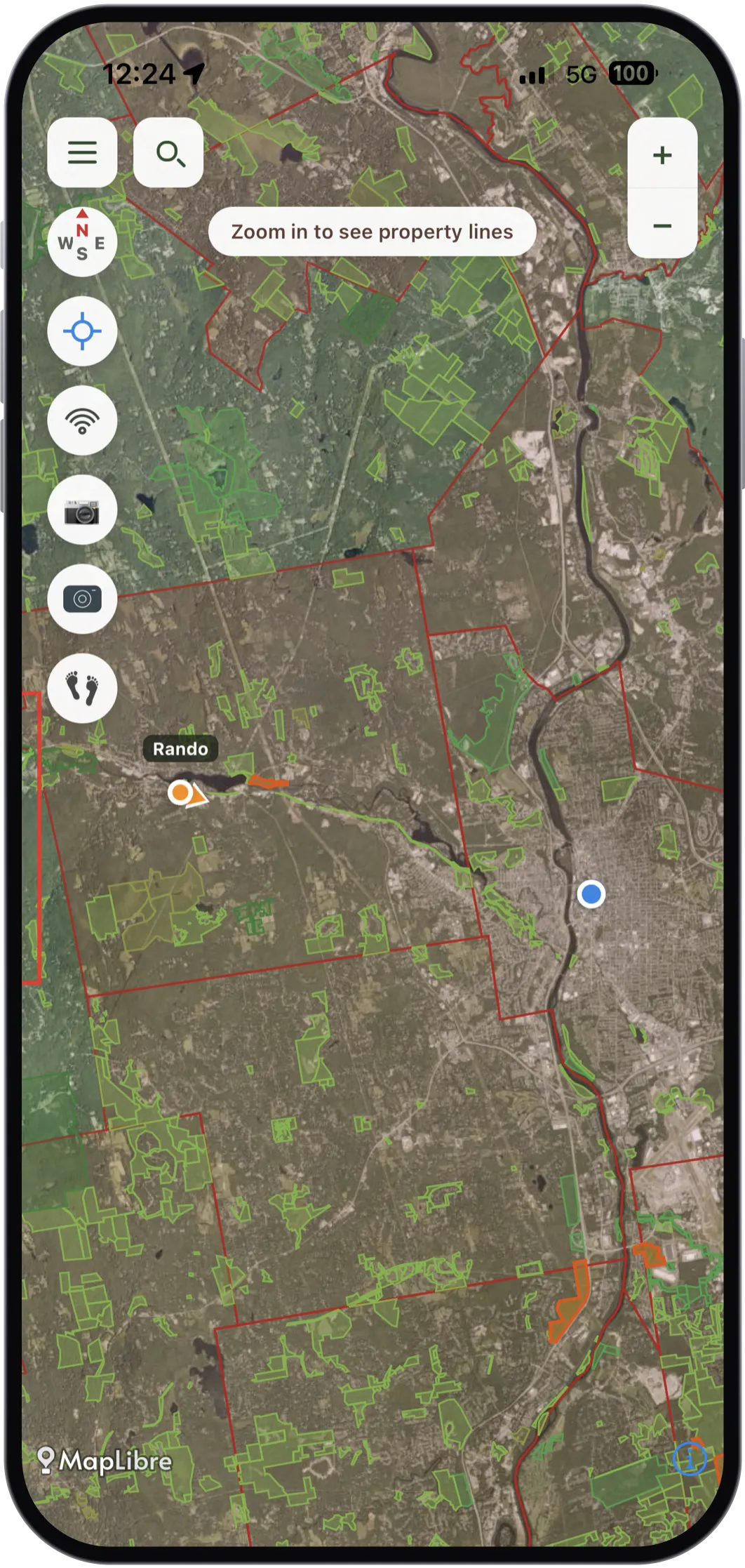
Not a mockup. A buddy live on the map, public land, huntable ground and the weapon-restriction boundary, all at once, running today.
Everything else on this page is table stakes. These two are the bets, and they are the two things the app was going to live or die on. Both work on a phone now, which is why there are no illustrations left on this page.
Start a crew, go live, and everyone's position moves on the map in real time, with the phone locked in your pocket. Anyone who drops out of signal is marked as a last-known spot rather than left sitting there looking current.
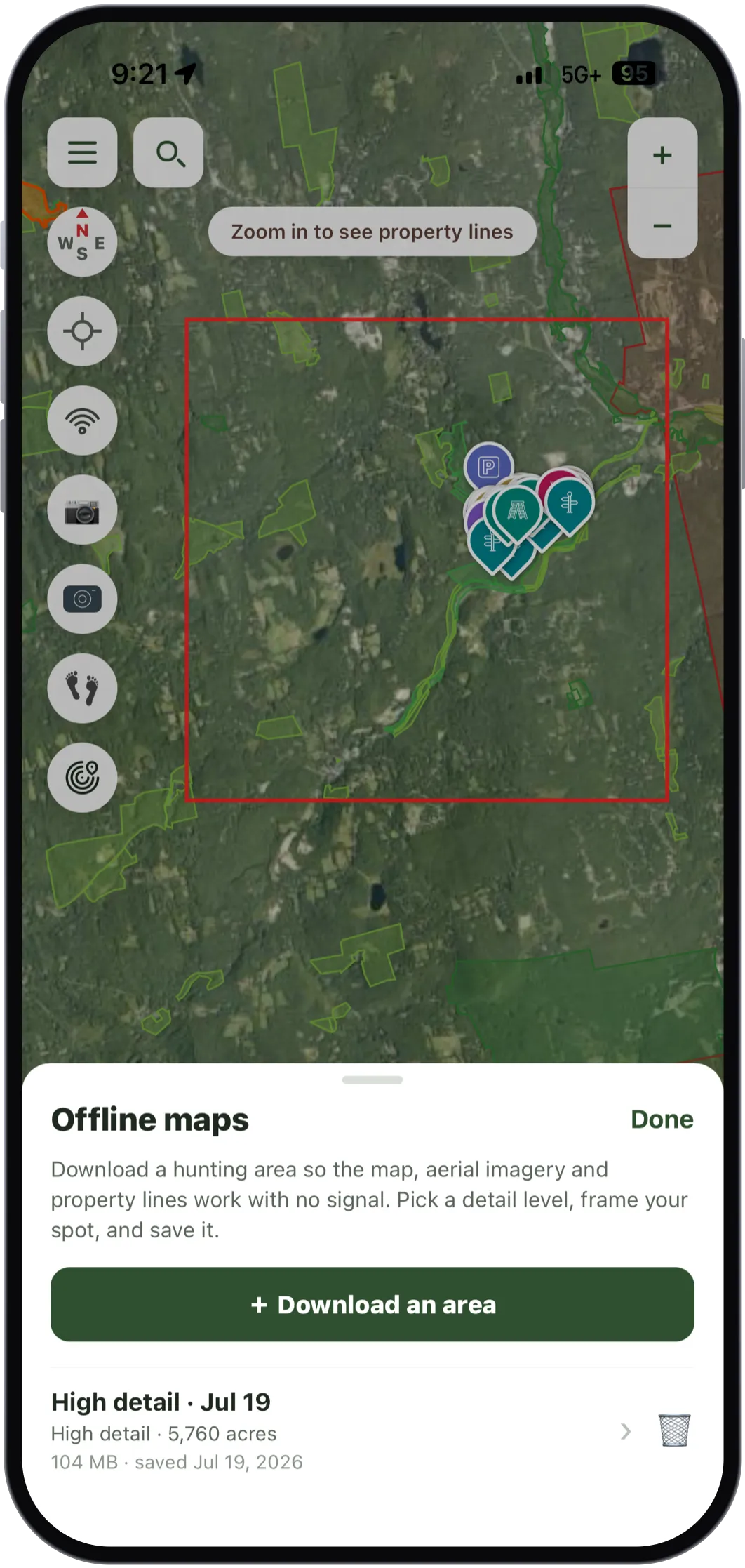
Frame a square, pick a detail level, and the topo, the aerial imagery and the property lines for it live on your phone. Verified in airplane mode, not in theory.
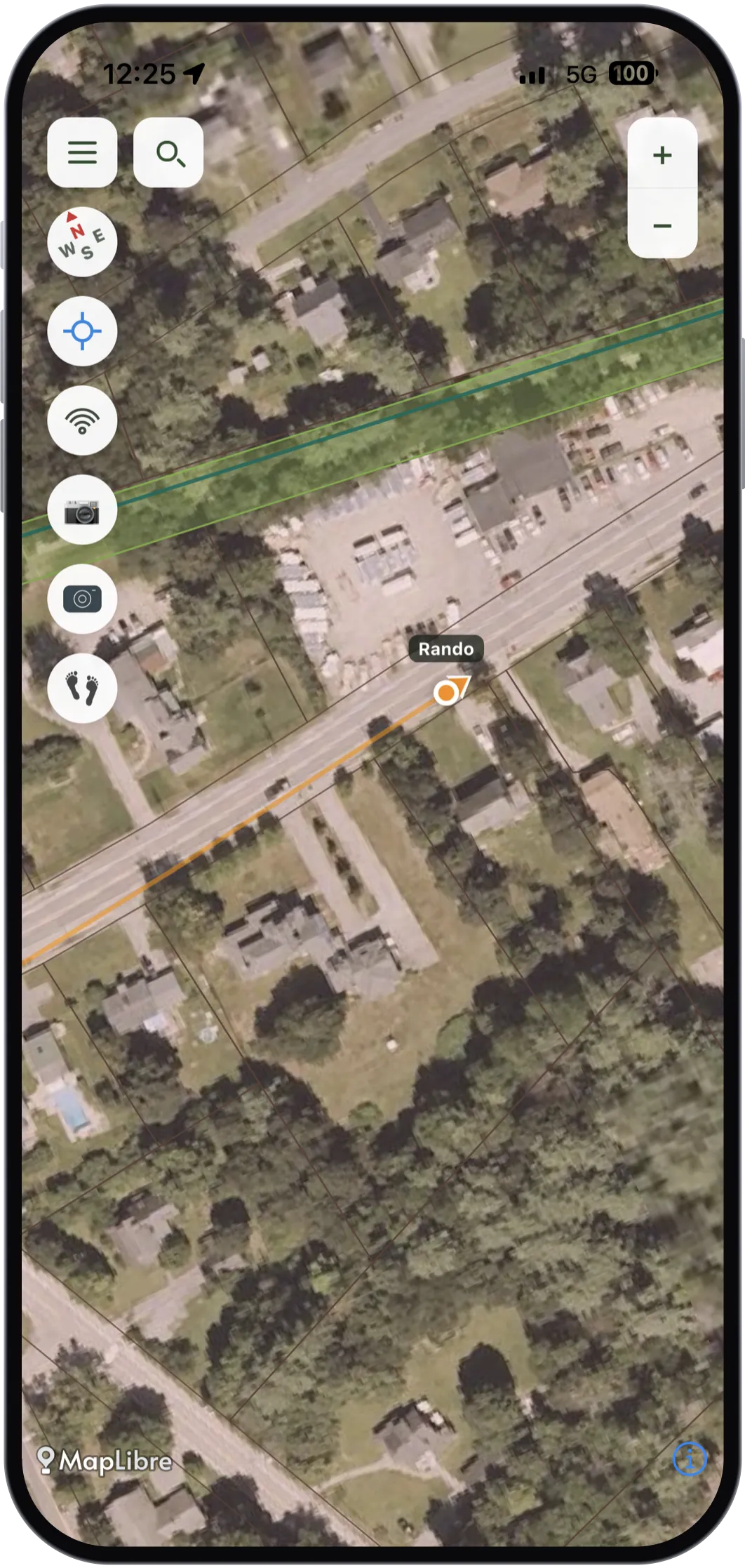
8,087 public-land parcels across New Hampshire, shaded by who owns them: federal, state, county and town.
Tap a piece of ground and get its name, its owner, and the acreage of both that parcel and the whole holding it belongs to.
20,268 trail segments across New Hampshire, and each one typed. Foot trails look one way; snowmobile and OHRV trails look another, because those often cross private land by the landowner's consent, and that is not permission to walk or hunt.
56 areas where New Hampshire restricts your weapon: 55 where rifles are off the table for deer, and one that is archery only. Plus your deer unit, resolved from the spot you tapped. The rules where you're standing, not buried in a PDF.
USGS National Map topo and satellite layers. Contours, wetlands, brooks and logging roads: the detail you actually navigate by.
Public land in New Hampshire is open to hunting, and all 8,087 parcels of it are shaded on the map. On top of that, the 123 wildlife management areas NH Fish & Game runs get their own layer, with what each one is managed for.
All 617,124 New Hampshire property boundaries are on the map today, and owner names on about 97% of them, so you know whose door to knock on. The name comes straight from the state's own parcel record, with its source and date on the card. Planning-grade data, not a legal record, but it either shows you the owner or admits it doesn't know.
Sixteen kinds of pin that match how you actually hunt: rubs, scrapes, beds, stands, parking, trailheads. Drop one where you stand, snap a photo onto it, or import the whole set you already keep in onX as a GPX.
Plant two fingers on the map to read the yards between them. Or drop into rangefinder mode, which pins you at the bottom of the screen, turns the map heading-up, and paints yardage lines downrange from where you are sitting.
Record the way in and the way out. Distance, moving time, pace and climb, drawn on the map as a line you can follow back out in the dark.
Sunrise, sunset and the day's forecast for where you are headed, and legal light worked out either side of the sun. Use your location or type a New Hampshire ZIP or town, and page through the next few days.
Turn wind on for a stand and the current reading rides on the marker itself, drawn as a tic pointing the way your scent carries. Cached per pin, so the last reading is still there with no signal, with its age on it.
Keep an inventory of your cameras (brand, model, whether it is cellular) then place each one on the map where it hangs, at your GPS position, with the direction it faces drawn as an arrow.
Two hunters standing in a dead zone can still pass a waypoint between them. One shows a QR code, the other scans it, iPhone to Android or either way round. No bars, no pairing, no account.
Each card names its source and its date: "Goffstown assessor · record dated Sep 2019". A confident owner name from a stale roll is worse than no name at all, and you deserve to know which one you're looking at.
Real screenshots, not renders. Everything here is running on a phone right now.
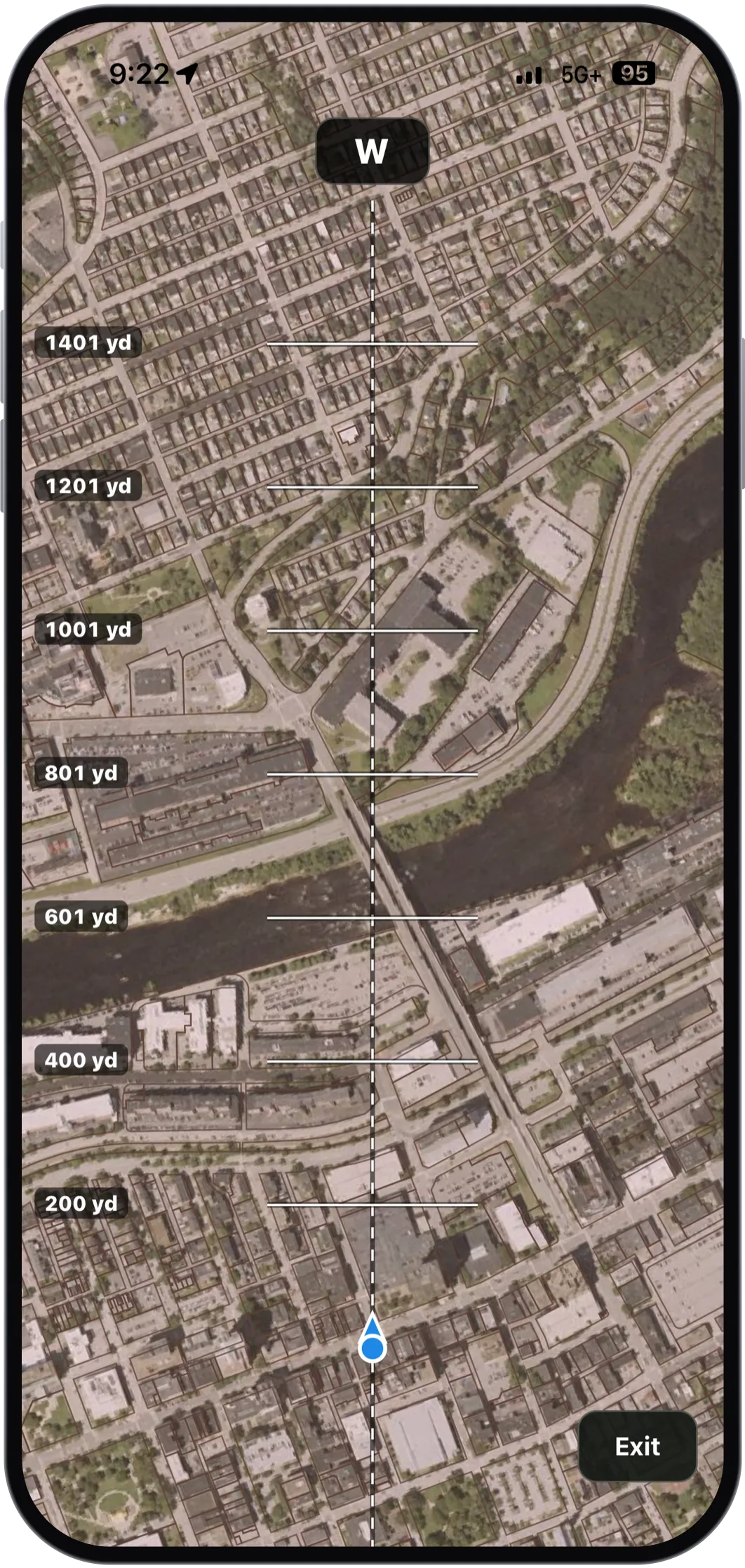
Rangefinder mode pins you at the bottom, turns the map to face the way you are facing, and paints yardage lines downrange. The compass point you are looking at rides on top.
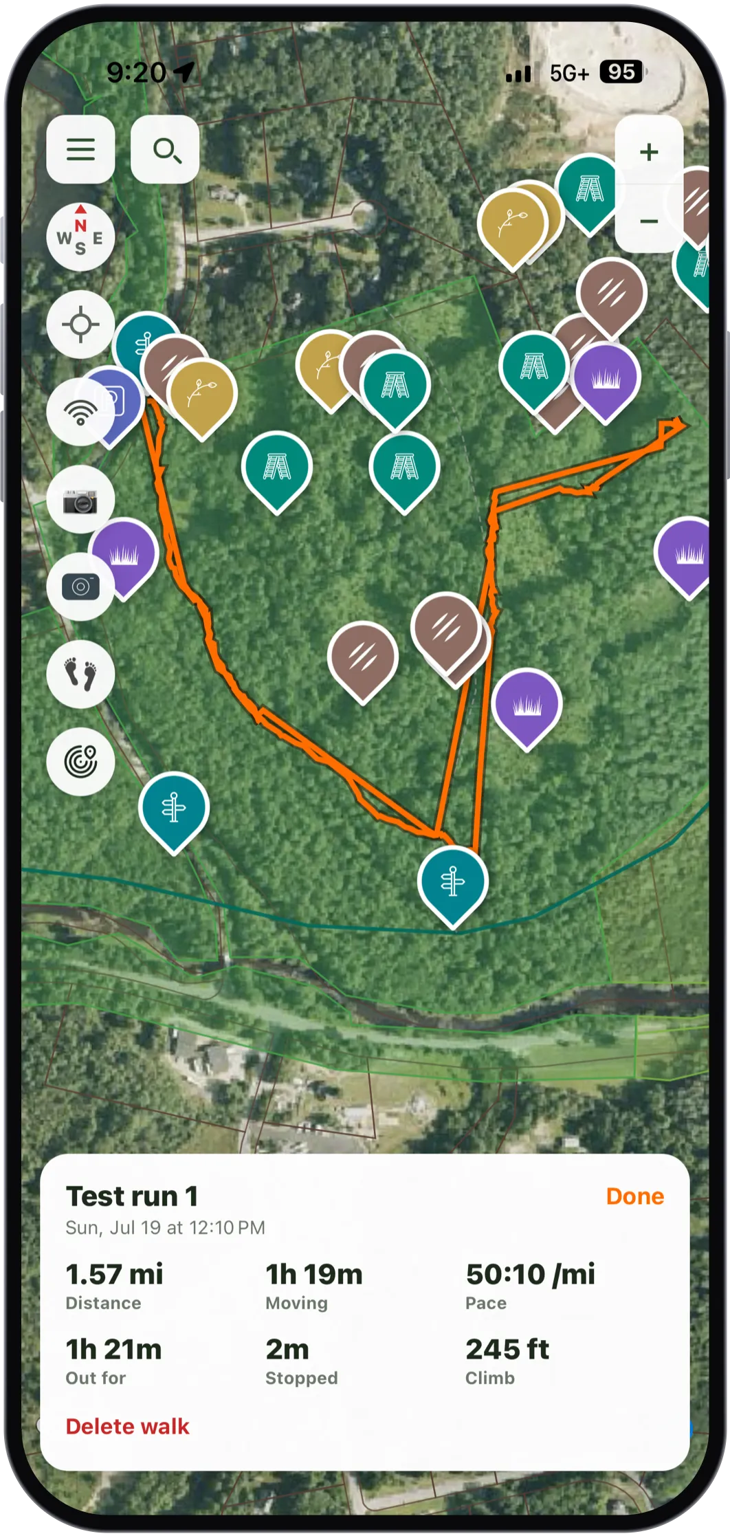
Record a walk and it draws on the map with the distance, the moving time, the pace and the climb. This one is 1.57 miles and 245 feet of climb, through a property already thick with sign.
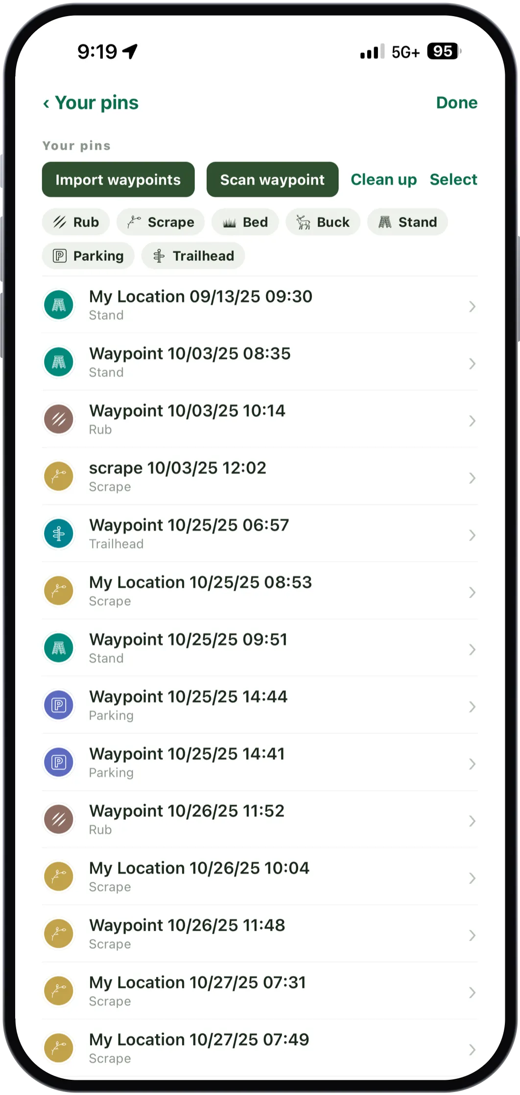
Rubs, scrapes, beds, buck sightings, stands, parking, trailheads: sixteen types, each with its own icon, filterable when the list gets long. Bring the ones you already have across from onX as a GPX.
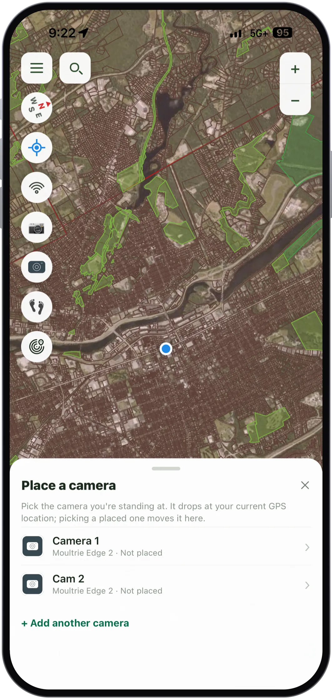
Keep your cameras as an inventory, brand and model and whether it is cellular, then drop the one you are standing at onto the map at your GPS position.
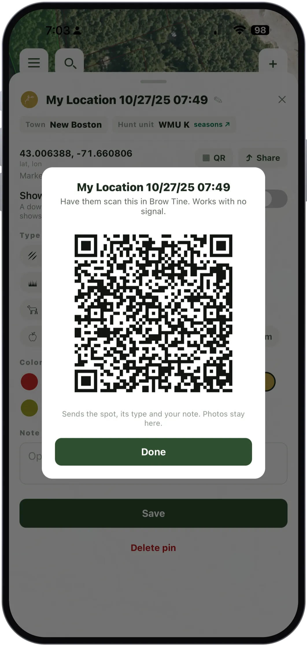
Show the code, the other hunter scans it, and the waypoint is on his phone. iPhone to Android or either way round, with no bars on either side. It carries the spot, its type and your note; photos stay put.
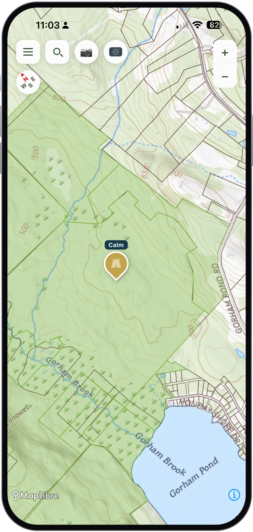
Turn wind on for a stand and the current reading rides on the marker, drawn as a tic pointing the way your scent carries. It caches per pin, so the last reading is there offline with its age.
Every card names its source and its date, and resolves the town and the deer unit from the point you tapped rather than the middle of the parcel. Where a weapon restriction exists it says so. Where none is mapped it stays quiet, because nothing on record is not the same as rifles allowed.
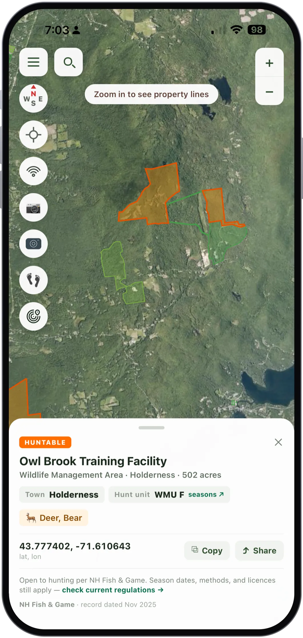
The 123 wildlife management areas NH Fish & Game runs get their own layer, with what each one is managed for on the card. This one is deer and bear.
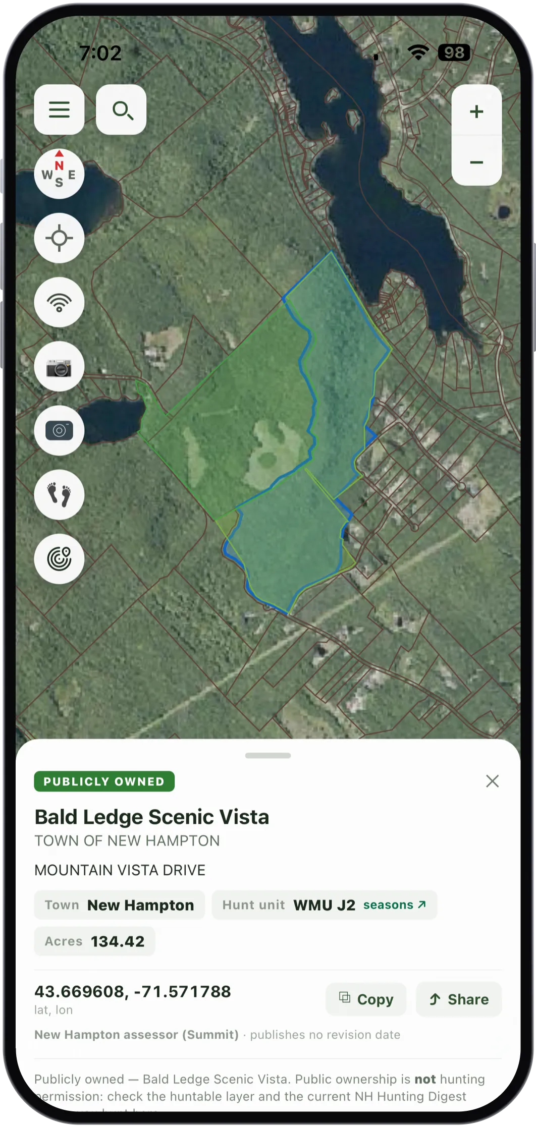
Public land in New Hampshire is open to hunting, so the useful thing a card can tell you is whose it is: the owner, the acreage, and the assessor record it came from. Private parcels carry the owner's name too, because that is how you work out who to ask.
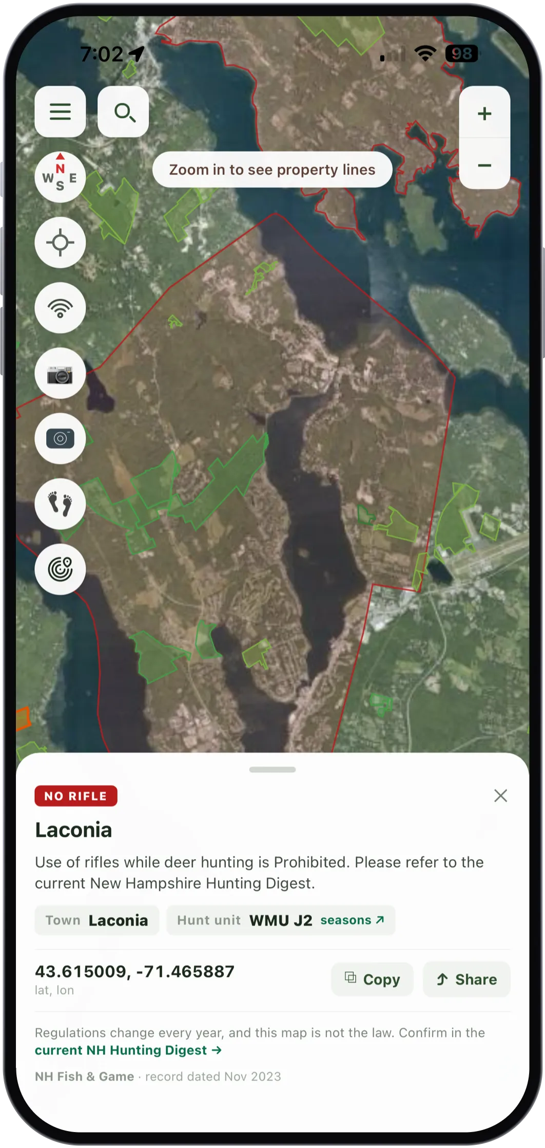
56 areas restrict what you may carry: 55 where rifles are off the table for deer, and one that is archery only. The card resolves it from the point you tapped, dates it, and sends you to the Digest, because the Digest is the law and this is a map.
The parts you set up once at the kitchen table, so the parts you use in the dark stay simple.
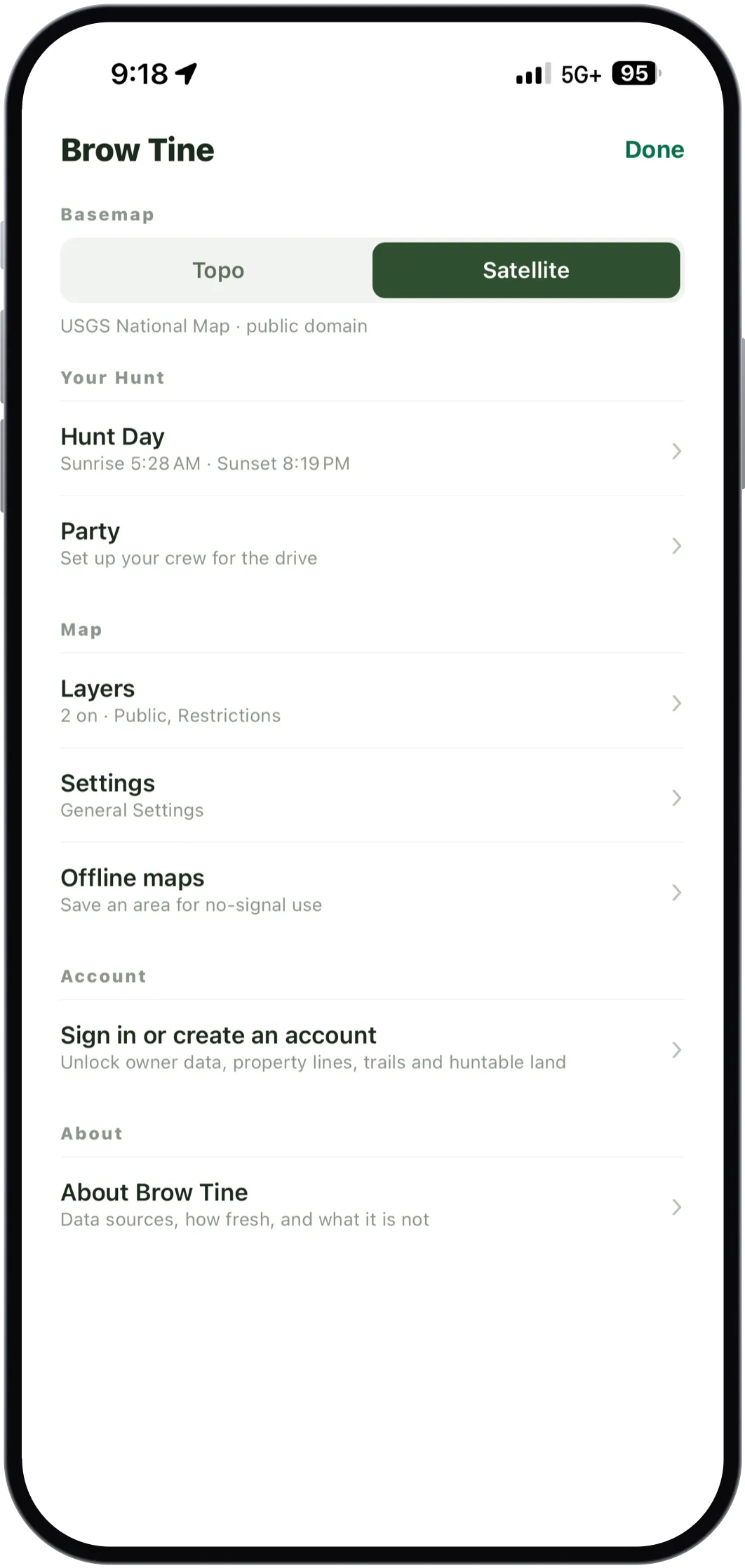
Topo or satellite, your hunt day, your crew, the layers, offline downloads. No hunting for anything.
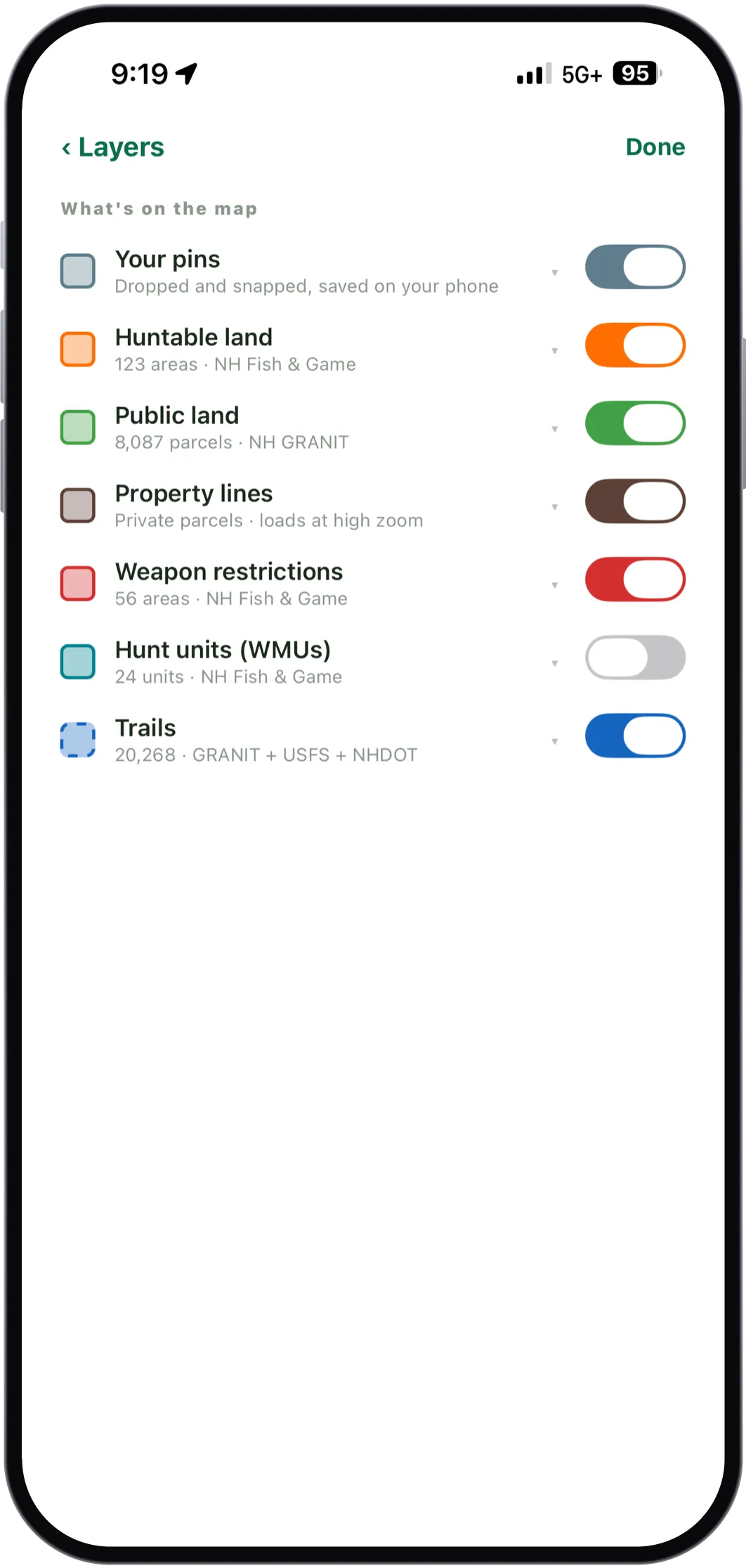
Every toggle says how many things are in it and where the data came from. Nothing on this map is unattributed.
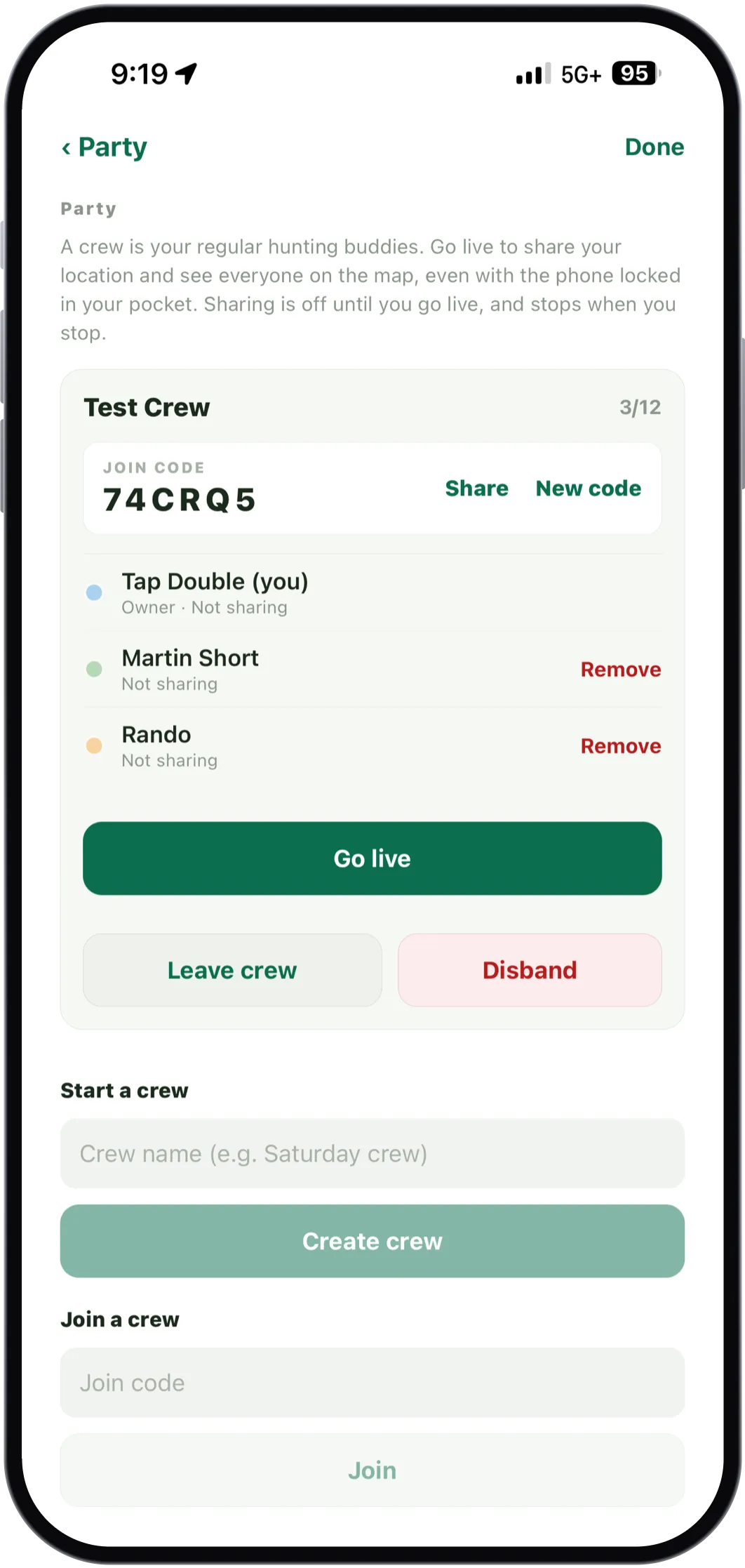
Name a crew, hand out the join code, and it is there next season. Sharing only runs while you are live.
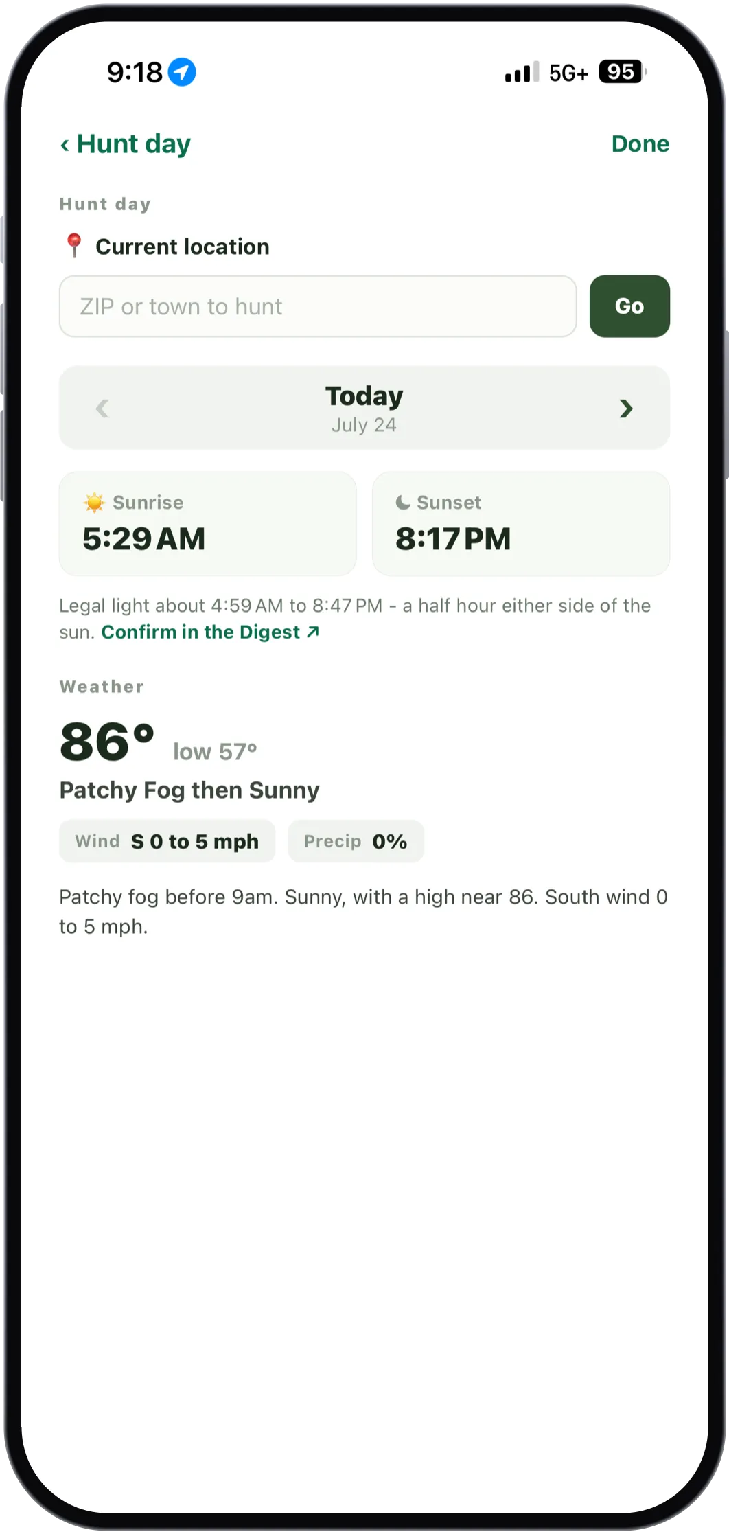
Sunrise, sunset, legal light either side of the sun, and the forecast for your spot or any NH ZIP or town. The sun times are worked out on the phone.
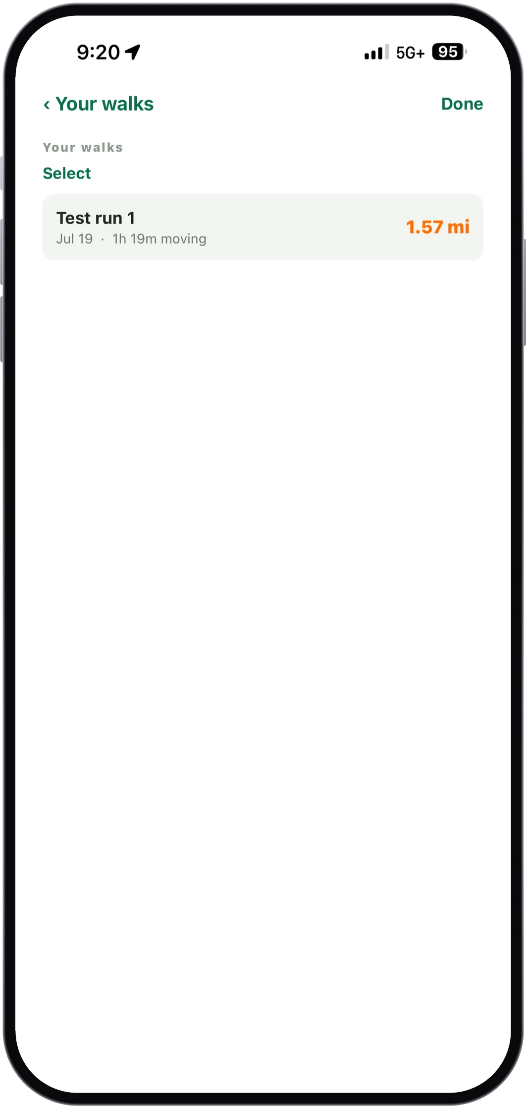
Walks are saved with their distance and moving time, and they sync to your account so the web build has them too.
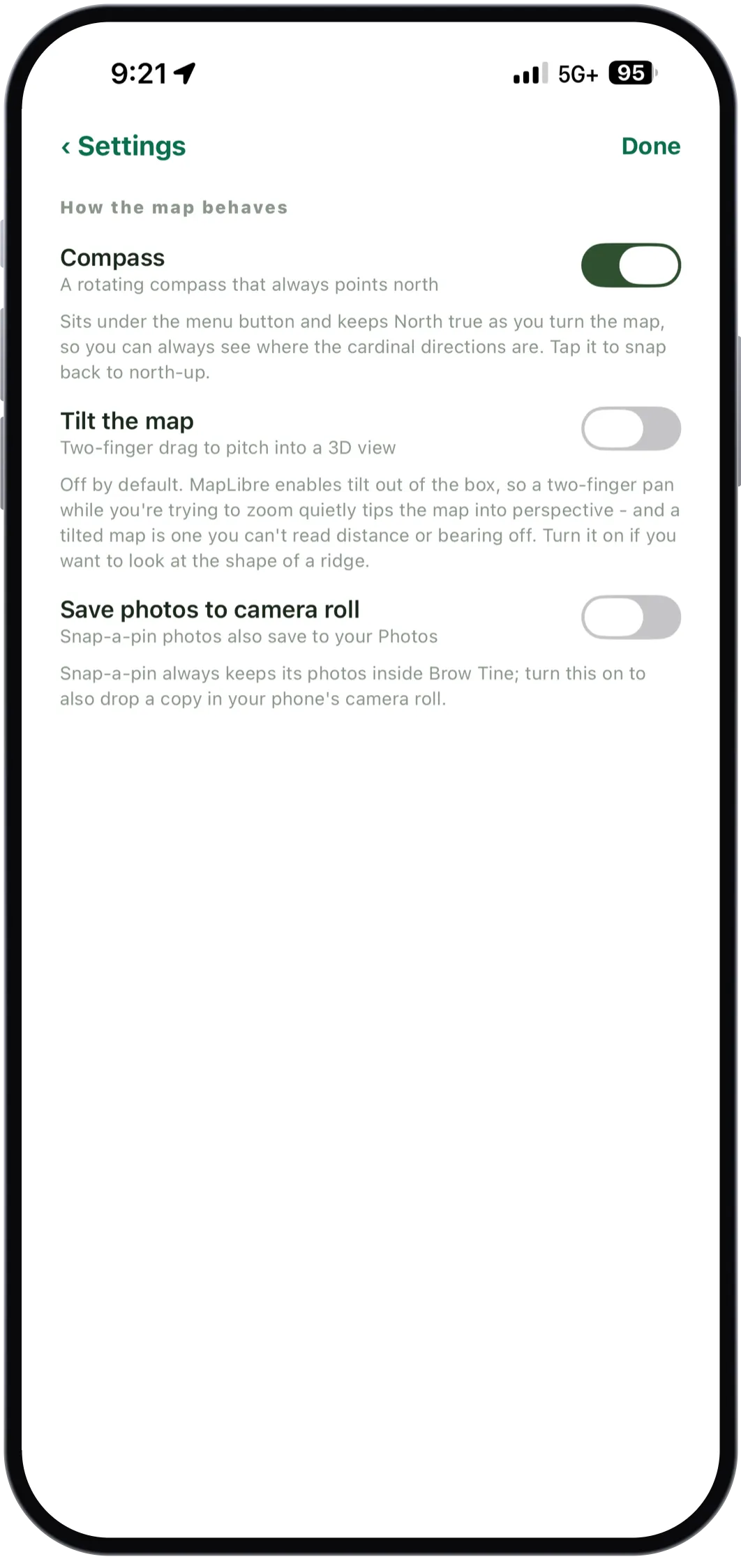
Tilt is off by default because a tilted map is one you cannot read distance or bearing off. The setting says so.
Some of this data is old, and some of it is missing. Goffstown's owner names are from 2019. NH GRANIT publishes no revision date at all for its trails. Neither is fixable by us, so the thing we can do instead is tell you: every card names its source and its date, and where the record says nothing, the card says nothing rather than filling the gap with a guess.
The owner names come from the state's own parcel record, which is planning-grade data and not a legal one. Use it to work out whose door to knock on, not to settle a boundary. And the Hunting Digest is the law, not this map. Getting that distinction wrong isn't a bug. It's a citation, or worse.